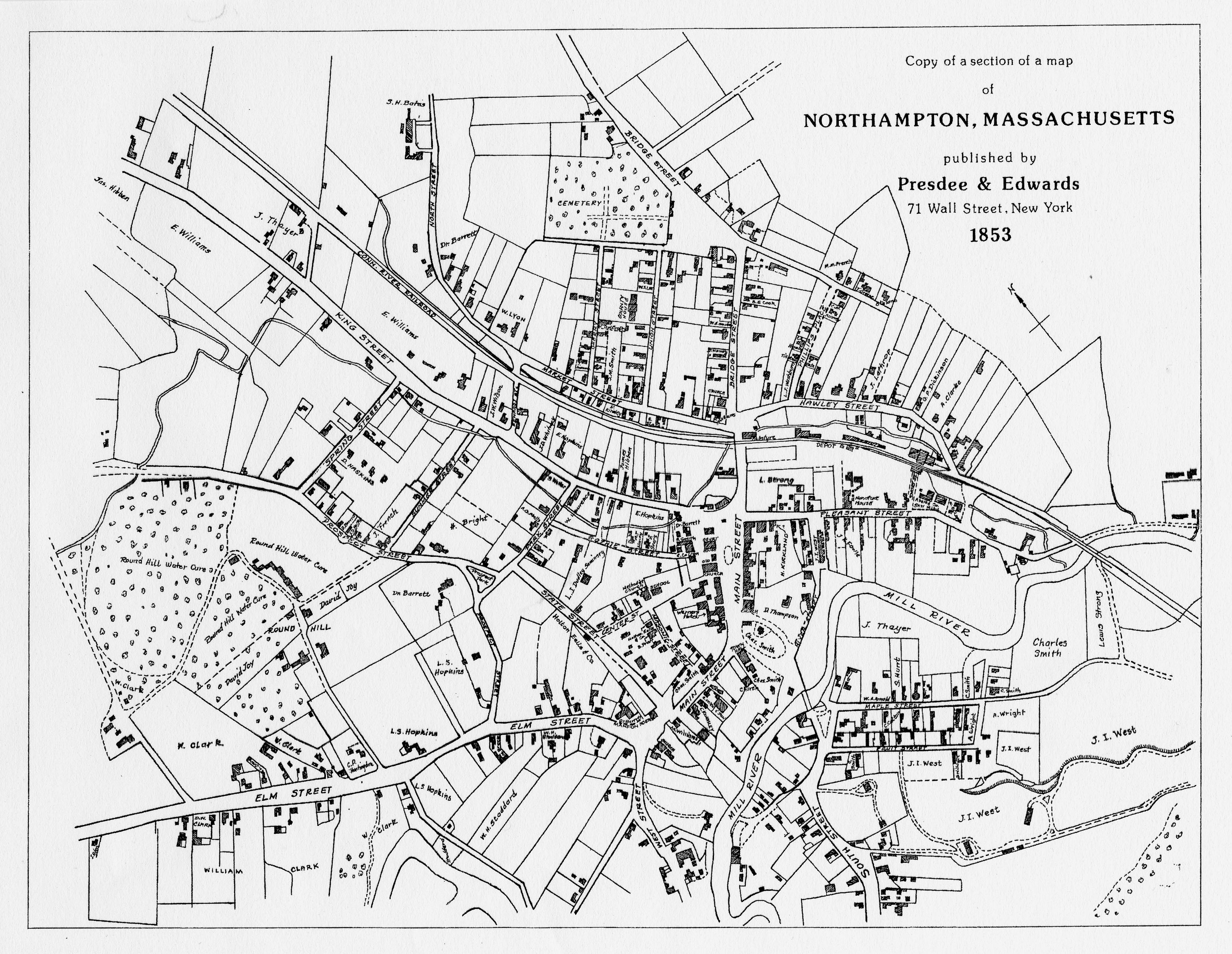


The 1853 Map of Northampton hows downtown Northampton a few years after the NAEI. The Hampshire & Hampden Canal in the 1831 map has been replaced by a railroad along Market Street. Smith College would not appear until 1871. The map is oriented with North on the left.
See also https://www.emergingamerica.org/curriculum/exhibits/radical-equality/background/sources/maps-northampton-1831-1853-and-1873.