English Dutch French German Italian Portuguese Russian Spanish

Search

Map of Northampton – 1853

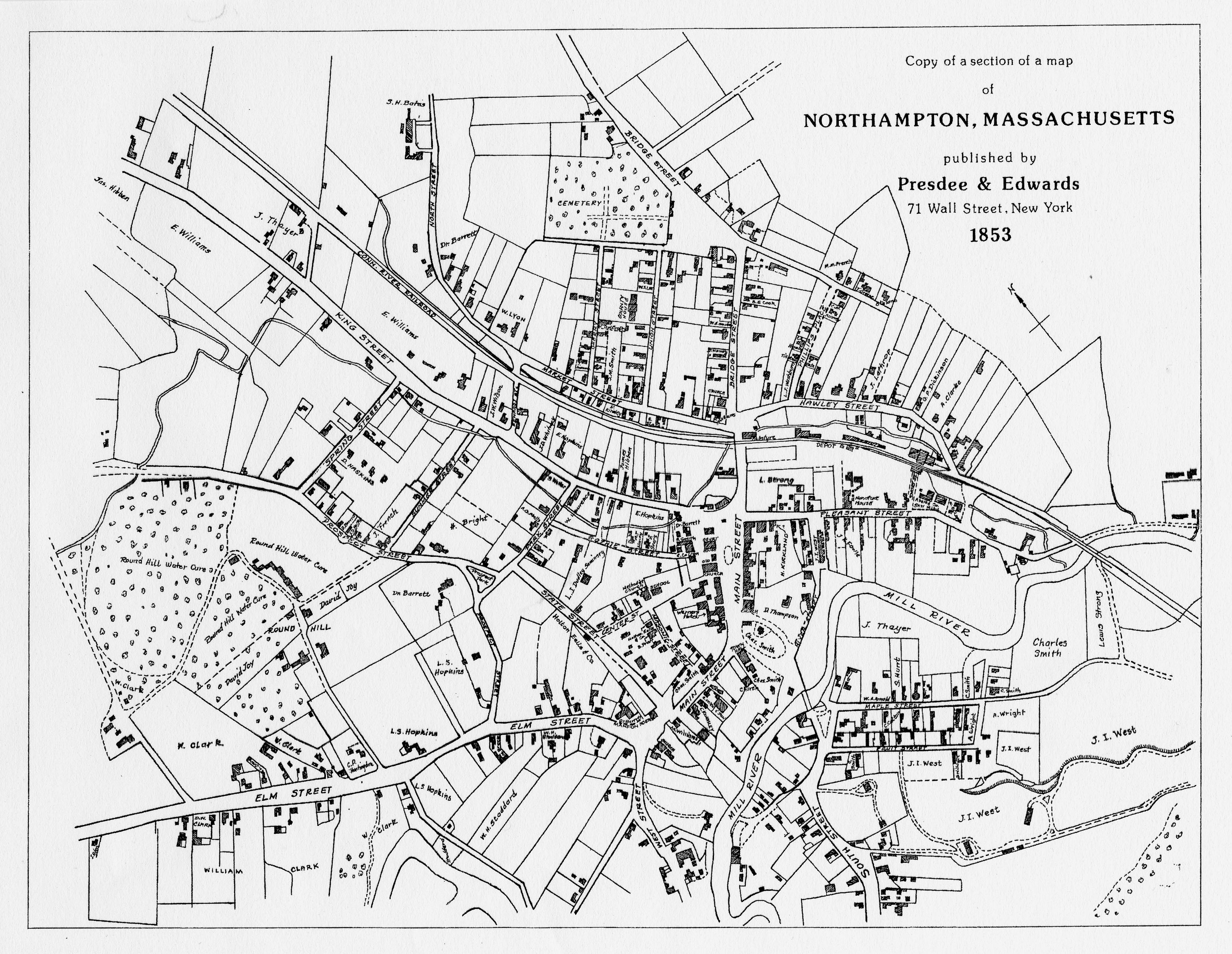
The 1853 Map of Northampton hows downtown Northampton a few years after the NAEI. The Hampshire & Hampden Canal in the 1831 map has been replaced by a railroad along Market Street. Smith College would not appear until 1871. The map is oriented with North on the left.

Upcoming Workshops


Register for the Webinar For teachers, student leaders, school administrators and community leaders. 
July 14, 2026 - Teach Disability History Conference - Harkin Institute, Drake University - Des Moines, Iowa K-12 teachers, instructors of pre-service teacher…
Resources for Teaching Disability History and Human Rights from the Virtual Conference  April 7, 2026 - 5:00-7:30 pm Eastern Time - Second Annual Conference…